DAY 29 ABLAIN SAINT NAZAIRE TO ARRAS

We said our goodbyes to Claire, Marc and their lovely dog Jaeger and headed for the Sucrerie Cemetery. What kind people and such comfortable lodgings.

The Sucrerie Cemetery at Ablain St Nazaire

The Sucrerie contains the remains of 221 British and 163 Canadian men who fell during trench warfare following the capture of the Vimy Ridge by Canadian forces in April 1917. Like all of these cemeteries it is beautifully kept and a sobering reminder of what we owe to those who fell.

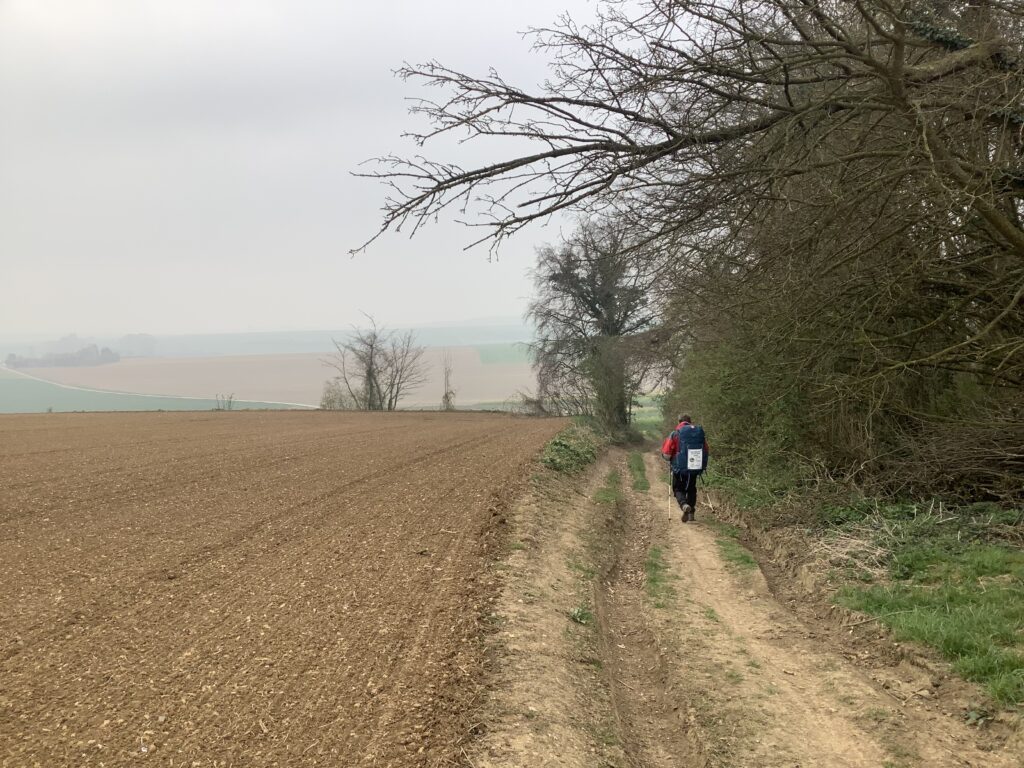
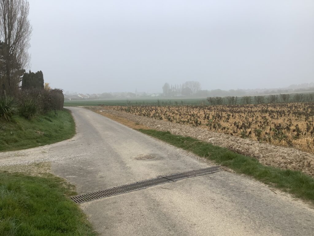
As we headed out of Ablain we passed the ruin of the C13th church which was mostly destroyed during French attempts to retake the village from the Germans in 1914. Most of the village was also destroyed.

Ruin of the C13th church in Ablain

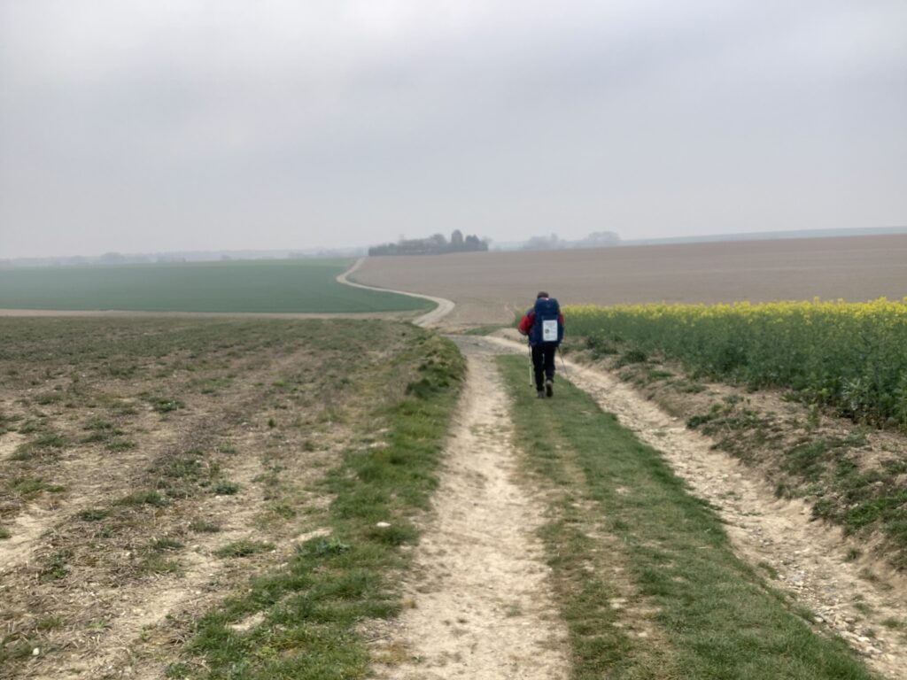
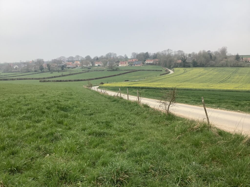
From Ablain we headed south to Carency and on to Mont St Eloi. The ruined abbey of St Eloi atop the mount is a prominent feature in the landscape for some miles away. Indeed, we had seen it in the distance during our visit to the French National Cemetery above Ablain Saint Nazaire yesterday.

Approaching Mont St Eloi

As we approached the mount we passed a memorial to both WW1 and WW2 soldiers who died at this strategic place. During the Great War the frontline was just behind nearby woods, and therefore within range of enemy guns. Amongst those killed in May 1915 was Francois Faber, winner of the Tour du France in 1909. In May 1940 57 soldiers died here attempting to hold back the German invasion of France.

Mont Eloi has spectacular views for many miles in every direction, but there was no shelter from the wind, which seemed to blow around every corner, so we quickly headed back down the hill.

View from Mont Saint Eloi

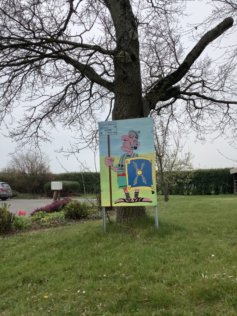
At a junction in the road we stopped to check our route on the map as the route signs were confusing. The local Mayor, who happened to be passing stopped, abandoned his car in the middle of the junction and came over to help us. He was very clear about the way to Rome, despite the confusing signs, and so we continued on our way. Just around the corner was a small French military cemetery honouring several hundred dead.

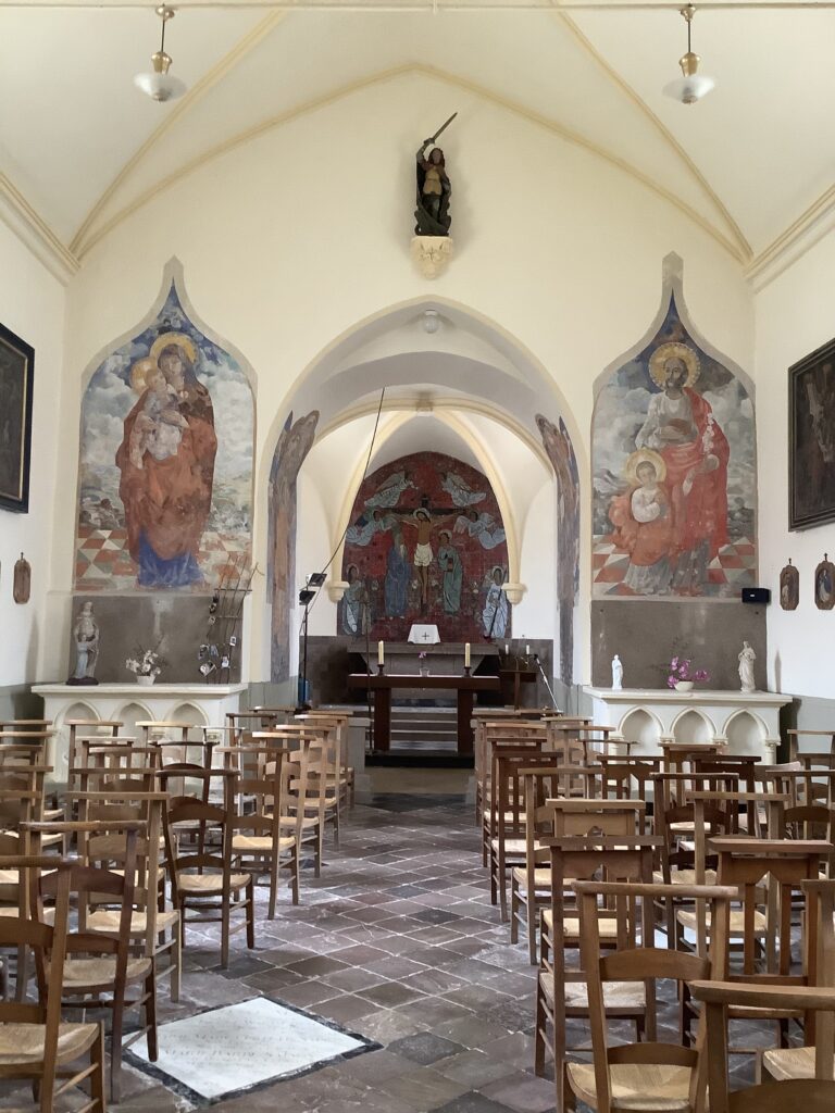
In the next village, Ecoivres, we found a conveniently located bench adjacent to the church for lunch. Looking around the church to see if it was open (it wasn’t) we found extensive WW1 graffiti made by soldiers waiting to be sent to the front, though sadly it had been defaced by more recent ‘artists’. An inscription made by D W Boag of the Canadian Infantry was probably typical. He was a student in Ontario and had signed up in 1916. He was in Ecoivres on 03 July 1918, five days before his 21st birthday. He died one month later in fighting on the Somme, and is buried at Bouchoir.

The next stage of the walk was along a track which cross-crossed a single track railway line. There was a team of men working on the line who, noticing our walking poles, asked Tom where were his skis? They were busy shovelling gravel back up onto the line so we probably provided a welcome diversion from their tedious work.

In Maroeuil we had a pleasant walk alongside the river, although at this point it began to drizzle. The river was quite coloured up with suspended sediments and there were no fish to be seen!

The final stage took us alongside an out of town industrial area, and into the outskirts of Arras. There was a lot of new housing on the edge of the town, though more imaginatively designed and on larger plots than many of our homogenous and cramped new housing estates.

As usual, finding our way through urban streets was a rather tedious slog, and we were pleased to find our hotel centrally located in the Grande Place with a good choice of eating places around the square.

It is difficult to say that visiting military cemeteries was the highlight of the day, but we were very aware of being now in the thick of the WW1 battlefields area.

DAY 28 BRUAY TO ABLAIN SAINT NAZAIRE

An attempt to call a taxi to get back to the centre of Bruay to start the day’s walk completely failed. Apparently taxis don’t operate in Bruay on Sundays, and neither does anything else. There was even little sign of church activity. Strange place, Bruay.

The hotel manager took pity on us and offered to drive us back into the centre of town in his own car. A very generous offer, which went some way to redeem the events of the previous evening.

The weather was pleasant as we headed out of Bruay, with just a light wind and a bit of cloud. We dropped into an Intermarche to replenish our lunch stocks on the way. Soon we were on a disused railway which made for enjoyable walking on level ground. We passed a number of people out walking dogs and others enjoying the track by bike.

The old railway line to Houdain

The railway line took us as far as Houdain where we crossed the Lawe River and headed southwestwards. At one point we noticed a commotion going on by a crossroads with all traffic stopped. A cycle race was in progress and no cars were being allowed to cross. Such is the importance of ‘cyclisme’ in France that motorists just accept this. Fortunately no such restrictions seemed to apply to ‘randoneurs’ and we passed freely.

At Rebreuve-Ranchicourt we passed an interesting old water mill, but the church was closed. Around the corner is a substantial chateau seemingly recently renovated. Must be owned by a banker, remarked Julie. Good to see that someone is investing in the conservation of these historic buildings.

Leaving behind the village, we headed uphill through fields towards a long wooded escarpment the Mont de Baraffles, our first of several steep climbs today. On top of the hill, well hidden by the trees, is the extensive Centre Loisirs d’Olhain. Here there are numerous opportunities for camping and outdoor activities, including overhead tree walks, cycle and walking tracks, horse riding and even a large swimming pool. It was good to see plenty of people out enjoying them.

The ridge of le Mont de Baraffles

The multitude of tracks and paths made route finding for the Via Francigena challenging and we probably ended up walking twice as far as we needed. Getting off the escarpment proved even worse as the signs didn’t match our maps, and we eventually concluded that the path had been relocated. We ended up walking most of way the around a golf course back up the hill and down again, instead of taking the short route! However, views from the escarpment were spectacular.

Once clear of the woods we were back into open arable farmland and a mix of small roads and tracks taking us south towards Servins. Here we found three Commonwealth War graves amongst about 30 French military graves in the communal graveyard, all dating from 1915.

At this stage of the day, getting to our billet for the night became the priority, so we just slogged down the road and into Ablain-Saint-Nazaire with a bitingly cold northeasterly wind on our shoulders, heads down and teeth gritted. It was our longest day so far and we were very relieved to find a warm welcome from our hosts, Claire and Marc, not to mention their beautiful English setter, Jaeger.

Although we were much later arriving than planned, Marc very kindly offered to drive us up to the nearby French national cemetery of Notre Dame de Lorette which we’d missed by taking the more direct road. The battle lasted from October 1914 to October 1915, with the German lines on the Lorette ridge and the French in the valley below attempting to take the ridge. One hundred thousand soldiers were killed and as many were wounded. It is a truly moving place.

Notre Dame de Lorette French national cemetery

Adjacent is a commemorative memorial ring listing alphabetically and regardless of rank or nationality the name of the 580,000 soldiers who lost their lives in the Nord Pas de Calais area between 1914 and 1918.

The memorial ring in evening sunlight

One can understand why the Germans chose this ridge to establish their line as the views are extensive. Marc pointed out the city of Lille 40 km to the northeast, the Vimy Ridge which the Canadians took from the Germans in that heroic battle in 1917. We could see the city of Arras in the distance and the ruined abbey of Mont Saint Eloi which we would pass the next day.

Highlights and lowlights? Our visit with Marc to Notre Dame de Lorette and the French National Cemetery in the evening sunlight was the undoubted highlight. As for lowlights, well it was a very long day!

DAY 27 AMETTES TO BRUAY-LA-BUISSIERE

La Ferme des Deux Tilleuls

Our overnight lodgings at Amettes were warm and comfortable. Our hosts Collette and Jean Batiste were most kind and helpful. Collette’s parents used to run a dairy herd here, but when they took over they diversified. Amongst other things they bred rabbits for the table. Julie’s mother also tried rabbits on their farm in Devon, but it was difficult to make it economic.

The Church of St Benoit at Amettes

After saying goodbye to our hosts, we headed up to the church of St Benoit in the centre of the village. It was open and gave the impression of being well used. The story of Saint Benoit is a major theme of the church. He was born and grew up in Amettes. Concern for poor people played a big part in his life and his ministry. He is said to have walked more than 30 ooo km on pilgrimages criss-crossing western Europe. There are some lovely cartoon drawings of his life around the walls of the nave.

He died in Rome at the age of 35, and is buried there in the Church of Santa Maria di Monti. We made a mental note to visit his tomb, when we reach Rome.

Saint Benoit

The road out of Amettes took us down the hill and then back up onto the plateau where yesterday’s snow had half melted and frozen overnight. Fortunately we were late enough getting going this morning for most of the ice to have begun to melt!

Rejoining a minor road we walked past an interesting looking chapel and the church in Ferfay, both firmly locked against visitors. We were repeatedly told about thefts from churches which had led to them being closed except for services. We thought this rather sad as when churches were open there were people coming in to sit quietly or light candles, finding peace and solace.

Locked church at Forfay

As we were leaving Forfay we were first accosted by a driver asking if we would like to come with him for lunch, but as it was too early for lunch and we had a long way still to go we politely declined. Another man, noticing us checking the map near his house, came over to help and was interested in what we were doing.

The next stretch was very pleasant walking on a woodland track with the sun shining and shelter from the cold northeasterly wind still blowing. We inadvertently disturbed a bird of prey which had been feeding on a baby rabbit. We hoped it returned to collect its meal after we’d gone.

Walking into Auchel centre

Most of the rest of the day was spent walking through a former coal mining area, with many old slag heaps now regenerating naturally as wildlife sanctuaries and row upon row of miners’ cottages. First, though we walked into Auchel where the centre has been regenerated and found a convenient ly placed bench to sit on to eat our lunch.

Just around the corner Auchel’s church was locked up except for services, and so we continued our way southwards out of town. A lady stopped and asked about our pilgrimage. It is so reassuring when strangers ask about what we are doing. She wished us bon courage and we continued on our way. Round the next corner was a greengrocer’s still open – unusual on a Saturday afternoon in rural France – so we stocked up on more oranges. The shopkeeper noticed the banners on our rucksacks and started chatting to us in very good English. He said he was from Morocco and was very encouraging about our pilgrimage, pressing us to accept free bottles of water. He likened it to the haj.

One of many rows of miners’ cottages

South of Auchel the former mining villages merge one into another, with hundreds of back to back rows of cottages, each with its shed and a fair sized garden. It didn’t look as if the British lockdown passion for growing your own vegetables had arrived here, and although there were public sports facilities we were surprised that no one seemed to be using them on a Saturday afternoon.

Looking back towards Auchel

Before coming into Bruay-le-Buissiere, our destination for today, we walked through one more stretch of abandoned mining works along a level paved road blocked off at each end to prevent motorised vehicles from using it – though not E-bikes!


The last few kilometres were a bit of a slog along busy roads, taking us into and across Bruay-la-Buissiere as hotels are located on the other side of town. This is because they are primarily used by people on work projects who zoom in from the motorway. As they only stay during the week, hotels don’t offer evening meals over the weekend. After a very unprofessional rant in French the receptionist offered to book us into a restaurant said to be only a five minute walk away at an out of town entertainment centre. It took us 20-30 minutes so she had clearly never actually walked it herself! We would recommend that pilgrims bypass Bruay in favour of somewhere more hospitable to those travelling on foot.

Unusual dramatisation of Stations of the Cross at Amettes

Highlights of the day were the lovely church in Amettes, and the woodland walks, plus the friendly Moroccan shopkeeper who seemed to understand why we had chosen to do such a long walk.

DAY 26 DELETTES TO AMETTES

Well, it wasn’t really Delettes, but Upen d’Aval which is several kilometres north of Delettes, but we only realised this once we’d got to Delettes and had to tramp back up the hill into the face of a wet and bitterly cold northeaster. Nevertheless our chambre d’hote was very comfortable and our hosts most welcoming. We enjoyed a convivial meal with the hosts and two other guests from England who were touring the WW 1 sites.

During the night the weather turned bad. We were woken in the early hours by a loud clap of thunder and by morning there was a good four inches of lying snow. Was this a bad April fools joke?

In view of the snow and likely difficulty of route finding on footpaths and tracks, we decided to take the tar road directly east to Therouanne, where we could pick up provisions before turning south. Fortunately the roads had been cleared early in the morning by snowploughs.

Before leaving Upen d’Aval we stopped at the church of Notre Dame de l’Assomption. Not really very much to say about it other than that it was open and in a fairly poor state of repair. The reconstruction work started in the early 1990s seemed to have come to a halt some while ago.

We pressed on into a piercingly cold headwind, head down, focussed on putting one foot in front of another, and trying to ignore the developing blizzard. Definitely a bad April Fools joke.

The road to Theruanne

As we neared Therouanne the blizzard eased off and we took comfort from the relative shelter provided by the buildings.

L’Eglise du St Martin in Theruanne

The original church on the site of L’Eglise du St Martin had the status of a cathedral with an associated bishopric from 500 to 1553. In 1553 it was destroyed by the soldiers of the Emperor Charles Quint following the siege of Therouanne. It was rebuilt in 1617-23, but it was not until 2019 that a bishopric was reinstated here. The nearby monastery of St Augustine founded in 1156 was destroyed in the French Revolution.

The site has been one of religious significance since Gallo-Roman times when there was a temple to the god Mars.

We took the opportunity to stock up on provisions at the Carrefour Contact on our way out of town, before pressing on south. The wind rose and the sleet intensified on our left flank. It was miserable! Heads down and hoods up again, we soldiered on south.

The village of Estree Blanche, set down in a shallow valley, promised some respite from the bitter northeasterly wind. Sadly the church was locked so we searched for a sheltered place to sit and chew our sandwiches. We found it in the coach’s hideaway at the village football stadium!

Just beyond Les Vieux Coronas we picked up the route of the Via Francigena again. Tom was intrigued by the name of the place on the bus stop sign – Transvaal! We later learned that miners from this place had gone to the Transvaal in South Africa in search of work and had brought the name home with them on their return. Having done the same after university, Tom felt a connection with them.

From here our path took us through a landscape of abandoned coal mining activity, with prominent waste dumps (terrils en Francais) and derelict land, left to revert to nature. Despite the acidic pH of the waste, nature seemed to be doing a pretty good job without significant human intervention in the form of active restoration work.

From here we picked up a former railway line, conveniently running along the valley bottom, so out of the wind.

Former coal railway line near the Transvaal

Not long later a man walking his dog along the line approached. We stopped to exchange greetings. It turned out that he’d lived in Sydney where his wife had worked for P&O Ports, hence the coat he was wearing. He was unaware of the recent problems with the P&O channel ferries.

At Ligny les Aire the church was closed, despite a churchyard packed with richly adorned sepultres.

From Ligny our route took us back up onto the exposed plateau through Auchy au Bois and onwards to Amettes.

Finally the village of Amettes came into view, tucked down in the shallow valley of La Nave.

Shortly after, we found our lodging for the night at La Ferme de Deux Tilleuls, and a warm welcome by Colette and their lovely little dog Lulu.

Highlights of the day? L’Eglise du St Martin, for sure. We won’t mention the low lights!

DAY 25 WISQUES TO DELETTES

Today was one of four seasons in one. We woke to a cold northerly wind and snow showers. What a contrast with the July like weather we’d been experiencing since Canterbury. All good things must, of course, come to an end, but there’ll always be something around the corner. Matt from Brussels who was to join us for the day on Friday e-mailed to say that with the forecast of snow he’d decided to cancel as he had to be back on Saturday and couldn’t afford to get stuck.

We bade farewell to Soeur Lucie and our student friends at the Hotellerie St Charles. What a wonderful lady she is, so kind and welcoming. She told us she’d been sixty years at the Abbaye – thirty years working in the gardens and thirty years running the Hotellerie. She described the live as “difficile mais belle, ensemble”.

A break in the weather as we left, gave us a lovely view across the plains from the Abbaye. It was a very special place to spend our rest day. We felt really quite privileged.

Soon after leaving Wisques we crossed the A26 again; the whizzing route to the south.

Not long after we were hit by a fearsome shower of hail, snow and rain all in one. We scrabbled to get rain gear on and covers over our rucksacks. No sooner had we done so than it eased off and the sun reappeared.

Just before the first shower

We descended the valley into Esquerdes and crossed the River Aa. Tom was reminded that the Aa was one of the favourite Artois chalk streams of his friend Jeremy Lucas. With recent rain it was running quite coloured today.

The Aa at Esquerdes

From the bridge our path took us west along the river bank until we found the church. Another one sadly locked up and inaccessible.

An interesting feature, however was an ‘arbre de paix’ planted to commemorate 8th May 1945, presumably the date the village was liberated.

Tree of peace at Esquerdes

Our thoughts turned once again to Ukraine.


From Esquerdes we climbed out of the valley to the south entering a large area of woodland, the Bois de Esquerdes, which gave us welcome shelter from the bitter north wind.

As we emerged from the forest a group of huge wind turbines appeared on the horizon. How awful these things seemed when they first appeared in our landscapes two and a half decades ago. Yet now they seem quite normal, despite the noise when close up.

The sky cleared, the sun shone, the north wind blew, the sky darkened once again and it snowed. Thrice perhaps before we found somewhere to sit for some lunch.

Lunch

Then it proceeded to snow again!

At Dohem we found the church open and a welcome shelter from the storm. A rather less ornate affair than many we had encountered, but we could find little information on it, not even an indication of its dedication. It didn’t seem to be well used, but we found an intriguing dedication to Justine Fiolet who was remembered for having founded a boarding school. We wondered what kind of institution it had been given her grim look!

From Dohem we continued on south to Delettes taking a deeply sunken track which gave some respite from the bitter north wind.

It was only on arriving at Delettes that we realised we’d overshot the hamlet where we’d booked our overnight lodging, necessitating a grim trudge back up the hill directly into the snowy and bitter north wind. By the time we arrived we were wet and cold. Thank goodness for the fabulous wood burning stoves!

Highlights for the day? Well, not many, but the brief periods of warm sunshine were lovely, and the distant views now that the air had cleared, too.

If you are reading this, do please send us your comments – we’d love to know that someone is reading these!

DAY 24 REST DAY IN WISQUES

The Hotellerie Saint Charles, a former hunting lodge in the grounds of the Abbaye de Notre Dame on top of the hill, is perfect for our planned rest day (we promised ourselves no more than five days marching without a day’s rest). Its faded grandeur belies its level of comfort, with large rooms and tall ceilings. The window of our room looks out over the garden and the plains below, toward Saint Omer.

There are seven rooms, a well equipped kitchen and adequate bathrooms. Occupying the upstairs rooms is a group of university students, taking advantage of the calm and quiet to revise for exams. All four are studying English and are keen to practice on us. How ironic that we should walk all this way and not be able to get a French word in edgeways! Evening meals are taken in the Abbaye, though not with the nuns, and we don’t have to be silent!

LAbbaye de Notre Dame

At lunchtime we gave ourselves a treat at the Hotel-Restaurant La Sapiniere, just around the corner. We’ve stayed here on a number of previous occasions when on our way south from the Tunnel with the car. The Waterzoi d’egelfin (haddock) was especially good.

Finding accommodation ahead has not always proved as easy as we’d hoped, but Soeur Lucie, who runs the lodge, has been especially helpful with recommendations and contacts. Tonight we plan to attend Compline after supper.

The weather is soft but grey. Tomorrow’s forecast? Snow! Oh well, we’ll cope.

DAY 23 TOURNEHEM-SUR-LA-HEM TO WISQUES

Having been forecast for rain most of the day, we awoke to a cloudy morning, distinctly cooler, but thankfully no rain as yet. We scurried around the village trying to find the Tabac with the church pilgrim stamp, but had to make do with the Cafe de la Maisie’s own. However, whilst scurrying we were just in time to rescue an old lady who had come outside in her dressing gown and slippers to open her front window shutters when the last remaining hinge fell off, leaving her holding up a large piece of wood in considerable distress about it falling on her. We crossed the road and took the shutter from her, picked up the metal hinge and pushed it back into a hole in the wall.

Heading out of town, we were again on farm tracks crossing undulating farmland in the mist.

Mostly huge areas of arable crops, interspersed with small patches of woodland. Again, we noticed only larks surviving in the prairie fields, contrasted with a cacophony of small birds on approaching wooded areas. Without hedgerows, there is simply nowhere for small birds to live. Today, several farmers were dashing around on tractors with spreaders full of chemical fertiliser, presumably in anticipation of the forecast rain.

We crossed the A26 Motorway, just north of Culem and stopped to watch the traffic whizzing by, just as we have whizzed so many times before on our way to the Alps or the south.

The whizzing way to the south

Later in the morning we walked through some smaller farms with small fields in mixed use and abundant hedgerows. A relief from the swathes of arable monoculture.

Just before lunchtime the origin of yesterday’s concrete lorries came into view at a former quarry site which was in the process of backfilling and restoration.

As lunchtime approached the rain forecast for 10am caught up with us, and we made a dash for the church in Grand Difques, hoping to take shelter and relax over our sandwiches. Sadly, this one was firmly closed and, judging by the notices outside, was last used in October for a service of commemoration for those lost to the Covid pandemic. Otherwise, there was a well kept cemetery full of large ornate family tombs, which dare we say (quoting Bill Bryson), suggested too many people, but not enough surnames.

Grand Difques church and a proper farmer’s gate!

Our route continued in a south easterly direction crossing successive chalk ridges and valleys striking northeast-southwest.

At Comette we found the dear little Eglise Saint Folquin, open. Fortuitously the lady who looks after it was there and kindly showed us around. Originally 15th century it had been rebuilt in stone in the 17th century. The whole style and ambiance of the the building is much less ornate than others we’d visited on our route.

Eglise Saint Folquin de Comette

Particularly striking was a window in the sanctuary depicting the Virgin Mary and the Angel Gabriel.

Unusually, we found the ‘tampon’ and duly stamped our Pilgrim Passports. We thanked the lady who showed us around and headed off on our way.

Leaving Comette

At the next village someone with a sense of humour and perhaps a wish to encourage pilgrims had erected a sign confirming that we’ve covered 107 kilometres from Canterbury, and have a mere 1648 kilometres to get to Rome. We already knew we are slow walkers!

Another stretch along minor roads brought us into the last village for the day, Leulinghem, where we found the carefully tended Commonwealth War Graves of three young airmen who lost their lives on 24 June 1944. As this was soon after D-Day we assume had been providing air cover for the Allied troops who were then fighting their way into France. We will need to research this in more detail. They were Flt Lt JA Edward DFC, pilot, RAF; Flt Sgt S Isherwood, air gunner, RAF; and Pilot Officer TWP Price; air gunner, Royal Canadian Air Force. All three were in their twenties.

The church in Leulinghem was also open, and relatively simple in style, but it had no pilgrim stamp. It’s curious how accustomed we British are to seeing the less ornate churches we have had since the Reformation, and how shocking is the heavily ornate gilding and idolatry found in some continental churches. On the other hand, the architecture of the village churches we’ve seen so far has been unremarkable and less elaborate than many a gothic English parish church.

On the way through Leulinghem we noticed many posters in gardens stating ‘non a l’extension de la zone’ and assumed there are plans afoot to extend the nearby industrial area to the south west of the village.

A few kilometres further on we came to the outskirts of Wisques, our destination for the day, and the Abbaye de Saint Paul, a Benedictine monastery favoured by pilgrims wanting a quiet stay as this monastic order follows the rule of silence and accommodation is reputed to be in single spartan cells. We carried on for another kilometre to the Abbaye de Notre Dame, a convent of 19 nuns who offer lodging for pilgrims in a former hunting lodge in the abbey grounds. Unfortunately we arrived during Vespers so there was no one around, but we found a garden room open to sit whilst we waited. Soeur Lucie soon arrived: a delightful jolly lady. She greeted us warmly and said she’d received the message that we’d arrived. She showed us to a comfortable room overlooking the pretty garden.

View from the lodge

Highlights of the day? The pretty church at Comette and ………..tomorrow is a rest day. Hurrah!

DAY 22 LICQUES TO TOURNEHEM-SUR-LA-HEM

Having diverted by taxi to Ardres for our overnight billet, the first task of the day was to find a taxi for the return to Licques. This was where our kind hotelier stepped in and called no less than five taxi companies before finding one that was available. Most of the taxi companies seemed to be tied up with ambulance services, taking people to medical appointments.

We departed Ardres in thick fog, arriving in Licques as it began to lift. A search for un epicerie took us to a Carrefour Contact just out of the village where we stocked up on oranges, cheese and bread. From there our route took us to Audemfort where our otherwise perfect billet at the Auberge du Moulin was closed down. Was this another victim of the absence of visitors during the Covid pandemic? On the way we passed a farmyard entrance with quite the most spectacular display of Aubretia in bloom we’ve ever seen!

After the obligatory check for a trout in the River Hem, we began the climb back up to the chalk ridge we left yesterday. Several hairpins and a cyclist who repeatedly headed up and down, later and we were once again at the crest of the ridge with panoramic views across the Hem valley to the south.

River Hem at Audemfort

Part way up we passed a memorial stone to Mme Renee Locoche, who was killed by a V1 doodlebug on 23rd August 1944. We’d never thought that there may have been casualties from the doodlebugs this side of the Channel.

Over the ridge we met some telecoms workers repairing a fibre optic cable. We told them about our 22 day wait for repairs on the other side of the Channel, following Storm Eunice. They appeared shocked and surprised. Clearly they get a better service in France than we do.

The hamlet of Val

Descending off the ridge we entered the hamlet of Val, where cultivation of strawberries appeared to be an important agricultural activity. The automated dispenser of strawberries on the side of the road reminded us of the milk dispenser at Nunton, near the Salisbury Hospital.

Strawberry dispenser at Val

Fresh signs of spring continue to appear each day. Yesterday we were serenaded by plovers wheeling and diving. Was this a mating ritual or were they defending established nests? Today we watched a buzzard circling above us: the first we’ve seen this side of the Channel. No sign of kites yet, though. We found a horse chestnut in full leaf in Yeuse and a beech hedge just emerging. What a privilege it is to witness spring in this way!

La Chappelle de Notre Dame at Yeuse

We stopped at the Chappelle de Notre Dame at Yeuse, where we sat on a tree stump to eat our lunch. Down the road, the most exciting event to happen in the village in months was unraveling as one, then another concrete mixer blocked the road, delivering to a house building site.

The chapel was established in 1886 by Adolfo Belanger and consecrated by Georges Belanger, whose beatification proceedings are in progress in Rome. The walls of this chapel are covered with numerous plaques giving thanks for peoples’ safe return from war.

From Yeuse we headed east within view of the Calais-Paris railway line again, before turning back up onto the ridge. On the way we met a friendly mountain biker who stopped for a chat. He explained that he’d been doing bits of the Via Francigena on a day by day basis to fit with family commitments, but he was very encouraging about our doing it on foot. He wished us well on our way, and we him.

At the crest of the ridge we arrived at the ruin of La Chappelle de Saint Louis de Guemy. Built in the 15th century, it fell into disuse long ago and has been a designated historic monument since 1930. The views over the Hem and Val valleys from this high point are spectacular.

La Chappelle de St Louis

From the ruin of St Louis our route descended the south side of the escarpment down to Guemy. Here we found another church, seemingly abandoned, but with a cemetery full of large family tombs and others awaiting occupants.

Not long after we arrived at the village of Tournehem, our destination for the day. Crossing the river again, we had a good look for a trout but saw a shoal of Grayling (Ombre) in the shallows.

River Hem at Tournehem

Higher up the village we found the Eglise de St Medard. Originally 12th century, it has been rebuilt twice: once in the 15th century and again in the late 17th. What stands now appears to us as an over-adorned interior. The imagery of paintings and effigies is rather overpowering, and leaves little to the personal imagination of the worshipper.

L’Eglise de St Medard, Tournehem

Highlights of the day? The views across the Hem valley, Grayling in the river and the ruin of St Louis at Guemy.

DAY 21 GUINES TO LICQUES

Again the day started foggy, but this time it was really quite thick and took most of the morning to clear. Even then it was only partial with occasional glimpses of sunshine.

Leaving Guines in the morning mist

As we left Guines it was sad to see so many fields which had been treated with Glyphosate (Roundup) and were consequently without life. We felt sorry for the larks trying to nest in this desert of dead vegetation. This practice, which seems to have been expanding in recent years, is devastating for wildlife, for the health of the soil and demonstrates a lack of understanding, or perhaps disregard, for the vital interrelationships which exist between farming and the natural biological systems around it (read James Rebanks’ book English Pastoral).

Dead fields divided by newly (re)planted hedges!

After crossing the main Calais-Lille-Paris railway line our route took us into the extensive Foret de Guines. Here we enjoyed birdsong, dodged mountain bikers (today was Sunday) and heard our first French woodpeckers. It was too early for the bluebells, but in a few weeks they will be spectacular. The wood anemones and celandines were resolutely refusing to open on such a grey morning.

Once out of the forest we were back into farmland, this time more mixed use with established hedgerows, and notably more birds and wild flowers. At the the end of the Route de Mat we came upon a picnic table at the roadside with an interpretation board describing the Via Francigena – a perfect place for lunch!

From here our route took us via a rather tortuous path north, north west, then east, then south again causing us to doubt our navigation at several points. So far, however the Via Francigena signposting has been pretty reliable, and so it was today, delivering us to the crest of a formidable chalk escarpment overlooking Alembon and the valley of the River Hem.

Escarpment overlooking Alembon and the Hem Valley

At this point it’s worth noting for future pilgrims that there is little or no accommodation in Licques, but a Gite may be available in the village of Alembon. The owner, a former pilgrim herself seemed very kind and willing to help us out, but sadly, we’d already made other arrangements to divert to an Auberge in Ardres, 10km to the north.

As we descended off the ridge the Abbaye de Notre Dame at Licques came into view through a break in the woods.

Standing on top of a hill in the middle of the Hem valley, the Abbaye stands prominent in the valley landscape. Founded in 1075, just nine years after the Norman Conquest of England, the Abbaye had been a dominant factor in the development of social, religious and agricultural life in the area for more than 900 years. It was particularly famous for its breeding of turkeys. The principal abbey building of today is largely 18th century. Although used for regular parish worship, it is in a poor state of repair, with cracks in the block work over the chancel suggesting the need for some serious work.

aw(Nevertheless, the grandeur of the building persists. A fitting, yet humbling, place to experience the Lord’s presence. No canned music here.

L’Abbaye de Notre Dame at Licques

Being the end of our day’s walk, but with no locally available accommodation, we called a taxi to take us to Ardres, with a plan to return to Licques to continue tomorrow.

DAY 20 WISSANT TO GUINES

Our overnight lodging was a typical old fashioned French family-run establishment, of the type where you’d expect to find a bidet in your room. Actually we didn’t, but there was one of those squat little baths which demands olympic gymnastic flexibility to get in and out of. Fortunately it had a shower over, which made things easier.

Fortified by a wholesome breakfast, we left Wissant as the sun began to burn off the morning mist. We passed a signpost telling us that Rome was a mere 2080 km away and that we’d walked 50 km since Canterbury.

Thankful for small mercies, we pressed on. It made us think of Polar Preet, the female army officer who recently walked to the South Pole, who spoke of focussing on the next steps, rather than the distance to her destination. What wise words for pilgrims.

After a while we came upon what looked like a fortified farmstead of old, with buildings contained within a walled courtyard.

Onward and upward our path took us to the highest point of the day at Mont Couple at the northern end of a prominent chalk ridge. Here there the remnants of some significant fortifications – part of Hitler’s Atlantic Wall defences, including gun emplacements and block houses. The area is now designated a nature reserve and over the main gun site there now stands a large table d’orientation. Interestingly, this showed Rome to be 1284km away as the crow flies. What a circuitous route we must be taking! Perhaps more sobering was just how close Kiev is. Our thoughts turned to the plight of the Ukrainians at this time.

1284 km to Rome as the crow flies


As we dropped off the ridge we passed through an area of woodland where we saw bluebells for the first time this spring. How good it was to find both diversity of bird life and wild flowers in pockets of unmanaged woodland, in stark contrast with the lifelessness of the large areas of prairie-scale arable farming. We’ve seen very little bird life, except for larks, so far in France, and the only raptor has been a solitary kestrel seen today. We stopped to enjoy a woodland lunch.

At Landrethun-le-Nord we found the church of St Martin, all locked up with cobwebs over the doors. Quite a modern looking church, but perhaps rather inactive and seemingly not welcoming to passing pilgrims.

St Martin, Landrethun

It seemed something of an irony that the church notice board was advertising pilgrimages to Lourdes and Jerusalem, while making no mention of the pilgrim route passing its very doors.

More prairie farming followed more prairie farming.

As we approached Caffiers the processing plant associated with the limestone quarries dominated the landscape with a long line of mineral wagons waiting in the railway line. Up the hill to the centre of the village we found the church of St Eloi, another modern church, this time seemingly well used.

On opening the door we unknowingly triggered a switch delivering canned music and turning the lights on. The walls were adorned with the usual Stations of the Cross, effigies of the Virgin Mary and a rather prominent Joan of Arc. The lacework on the alter cloth was particularly striking. However, once again we found no welcome to pilgrims or reference to the pilgrimage route passing its doors.

Church of St Eloi, Caffiers

We prayed for forgiveness for the canned music and for the plight of the people of Ukraine.

The path beyond Caffiers revealed yet more prairie landscape until such point that the Via Francigena becomes completely obliterated by the plough, with signage no more helpful than telling us that the “propriete est prive”.

Using a combination of the official Via Francigena website and various online mapping apps we were able to establish the line of the path quite clearly, but the only safe place to walk without trampling oil seed rape or freshly sown ground was along a field drain cut deep into the ground. Thank goodness it was dry.

Ditchcrawling the line of the Via Francigena

On reaching the railway line carrying the Eurostar (at least that was recognisable) we turned up onto the busy D231 for the last few kilometres into Guines, our destination for the day.