A short train ride from Kearsney, near our overnight billet, back up the valley to Shepherdswell where we left off yesterday. On our walk to the station we passed a group of bin men at work. On greeting one of them “good morning”, his response was “good morning, young man”. Tom was rather tickled by that!
On arriving in Sheperdswell, we made our way to the church of St Andrew to pay our respects and stamp our pilgrim passports. A Victorian building, St Andrew’s was perhaps not as interesting as some of the much earlier churches we’ve visited along the way, but seemed to be well supported with a lively church community.

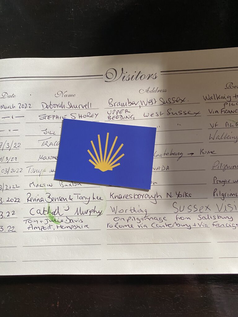
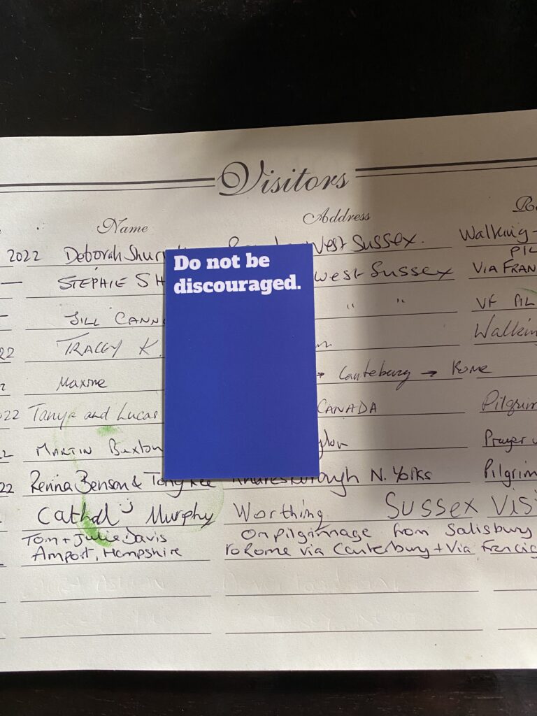
At a number of the churches we’ve called in on we’ve found little blue cards with the sign of the pilgrim shell and on the reverse side “do not be discouraged”. It’s clearly a message directed at pilgrims but we’d love to know more about what lies behind them. Maybe this will be revealed as we progress.
From Shepherdswell (also described as Sibertswold) we headed east through largely arable country. No more orchards or hop gardens. Soon we came upon another ‘artistic installation’: this time a wooden structure which at first we thought resembled the dome of St Peter’s in Rome, but according to the adjacent interpretation board represented a proposed cupola to top the Belvedere Tower across the valley. The title ‘Monumenta Romana’ suggests that we might have been correct in our assumptions.

The Belvedere Tower which is part of the Waldershare Park estate was a 18th century folly, probably designed by Colen Campbell for the Furness family who owned the Waldershare House and estate.

On the other side of the Waldershare Estate we came upon a small chapel dedicated to All Saints. At present disused, it is looked after by the Churches Conservation Trust. What a crying shame that the current owners of Waldershare House don’t take a more active role in looking after THEIR church!
Originally Norman, it has been much modified over subsequent centuries. Particularly striking are the murals behind the alter depicting the four Evanglists.

On leaving All Saints Julie took a nasty tumble on a piece of broken tarmac. Fortunately injury was limited to a grazed knee, but it was a reminder to us of how careful we need to be.

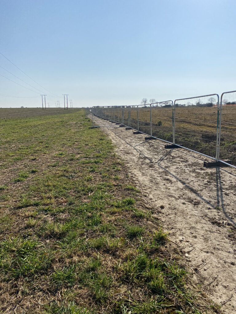
The approach to Dover which had been long anticipated – views of the channel and Dover Harbour – was something of a disappointment. First there was a significant detour to find a way to cross the busy A2 dual carriageway, followed by a second (so called temporary) detour to circumvent a construction project by Galiford Try. The project completely straddles and obliterates the Roman Road which the Via Francigena follows, diverts it by about a kilometre and when it rejoins the line of the road there is no signposting whatsoever. We understood that the reason for the diversion was for archaeological work to be done, but there was absolutely no evidence of anything happening, other than marking out for a new construction development! Surely, such a development should be designed around a Roman Road and ancient pilgrimage route like this? What are Dover District Council doing?
- *
The descent into Dover is distinctly uninteresting. There are no views of the sea, the port or the harbour. It’s only when you come upon the urgency of the traffic and the absence of waymarks for anything other than motorised vehicles that you realise you’ve reached Dover! So, once again we have to get the compass and GPS out to establish where we are and where we need to go.

However we did find Salisbury Road and a magnificent Magnolia, which made us feel welcome, given where we’d walked from!
Soon after we found our way to the sea front and our overnight billet with a harbour view.