After three months off and with our Brexit Credit accounts topped up, we’re on our way again by Eurostar to Paris, and then on to Turin and Pont Saint Martin tomorrow.
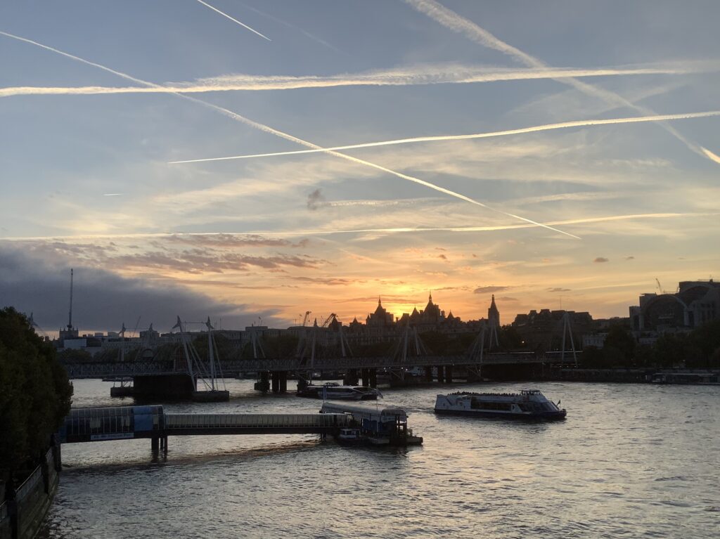
London at its best in evening sunshine
In the meantime we’ve enjoyed the rest from marching, but the need to get going again has been in the back of our minds all the time. Julie has managed to do some on-line working to top up the funds and Tom has enjoyed a bit of fishing, despite the very low water levels in our rivers. Together we enjoyed a four week trip on the boat down to the Channel Islands, back across to Devon and home again, studiously avoiding France to save our Brexit Credits.
Sunset in Poole HarbourAlways fun to see some of the wildlife
Tomorrow it all begins again. At least the weather forecast looks reasonable as we head into a distinctly more southern autumn. Our object is to cross the Po valley, traverse the Apennines down to the Mediterranean coast and then head south to Lucca (near Pisa) by the end of November.
As we head off on this next stage of our pilgrimage our friends Jenny, David, John and Maureen are very much in our thoughts.
Our most avid readers will have spotted that we had only walked to Chatillon yesterday, and yet we started from Verres today. The intervening section from Chatillon to Verres is 20 kilometres long, on the south facing side of the valley so in full sun all day, and billed as “challenging” which we understand to mean lots of ups and downs and rugged paths, like we’ve had for the last two days.
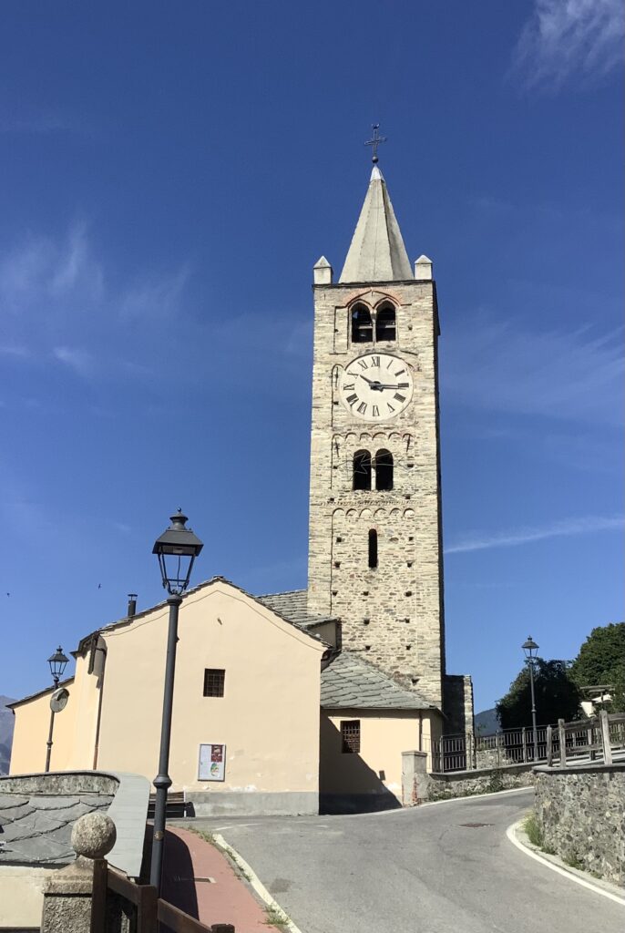
Pilgrim hotel in Verres – not a stay we’d recommend
We have found 12-13 kilometres of challenging walking to be our limit in the current extremely high temperatures, and Tom’s calf has played up under the strain. So, we decided to leave out the section to Verres and plan to do it when we return in the autumn, when hopefully the weather will be cooler and Tom’s calf will have had a break.
Early morning looking down the valley from our room
We decided to make an early start today, to get as much walking done as possible before the sun came over the top of the mountain. As we are walking more or less south, and the valley is narrow just beyond Verres, the sun didn’t hit us until 0915 and the wind also kicked in earlier today at about 1030, taking some of the sting out of the sun’s heat.
We liked the homage to emigres at Verres railway station
The valley is dominated by the Aosta motorway, which blights many of the small villages it passes, with the roar of traffic bouncing off the steep hillsides producing a stereo effect. Unfortunately traffic noise had bothered us for most of the night too as our pilgrim hostel was sandwiched between railway and motorway, and our room was on the motorway side of the building. We did not sleep well. The ‘hotel’ was very basic, but not cheap. Ablution facilities were communal, no plugs in the basins, and not even seats on the toilets!
The lady of the house and her daughter were delightful and welcoming, while the man of the house was surly and impolite. Having been offered breakfast from 0600 we opted for 0630 in order to get a few km under our belts before the real heat of the day, but he took 20 minutes to serve us! Even then it was with little grace and absolutely no “prego”!
His final trick was to leave the security gate at the end of the drive locked when we left, so we had to walk back to the hotel to request it be opened. Without even an apology he pressed the button for the vehicular (not the pedestrian) gate so by the time we got there it was already closing and Tom had to run to stop it from closing again, jarring his calf in the process.
FUTURE PILGRIMS – BE WARNED, DO NOT STAY HERE. OTHER PLACES ARE MORE DESERVING OF YOUR BUSINESS.
Looking across the river to Issogne
Once clear of Verres, we started by walking down to the river Dora Baltea which we then followed through flower meadows for a while. As we’d seen higher up, the river was white/grey with silt. We assume it’s snow melt coming down as there has been no rain for some time.
Lovely flower meadows as we cross the valley
We then crossed over the motorway, back onto the eastern side tucked under the mountains. At this early stage of the day, before the haze built up, we had a good view down the valley which is relatively wide at this point.
Morning sun just breaking over the eastern side of the valley – looking south
The first small village of Clos de Barmes was very proud of its wine producing heritage, and there were many vines being grown on small plots throughout the village.
Wine press on display in Clos de BarmesVineyards in Clos de BarmesA good crop of courgettes outside a traditional house with thick schistose rooftiles
Further along this side of the valley we came to the village of Arnad which has some very interesting old buildings and a fine example of a Romanesque church. Indeed, it is described as the prime example of a Romanesque church in the whole Aosta valley. Sadly, despite its significance, a notice said it was closed to visitors due to vandalism. Tom has left them a message suggesting that keeping churches open to people should take priority over preserving objects, otherwise the Church as an institution will die. Perhaps it already has, here? Higher up the valley churches were open and seemed much more vibrant.
Before leaving Arnad we were again struck by the notices we have seen in every Italian town and village announcing deaths and funerals of local people, several of whom have lived into their nineties, but a few have been much younger. We assume these notices take the place of our newspaper announcements, and they probably reach a wider audience. We would like to think that there was a good turnout for the funeral of the lady who achieved one hundred years old. What a good idea they are.
The path then took us back across the river, onto the western side of the valley. En route we noticed more of the signs we’d seen earlier, stating that an organisation was promoting the reopening of the Via Francigena after Covid brought pilgrimages to a halt, and no doubt decimated tourism generally in this economically deprived area. Typical bureaucrats – or perhaps politicians – to publicise their achievements without any obvious evidence for what THEY have done!
Back across to the western side of the valley
We had to tramp down a minor road, and then onto a dirt track alongside the motorway for several kilometres. It was not very interesting, and the dirt was pebbly so we had to be careful not to skid or twist ankles.
Looking back up the valley on the dirt track beside the motorway
Arriving at Hone we first walked through an area used for burying the 93 victims of a cholera outbreak in 1867. It now seems to be an area of allotments used for growing a range of vegetables and flowers. There are no obvious graves, but it may be that burials were hastily done in the circumstances and therefore the graves are unmarked.
Shrines commemorating the cholera victims of Hone
In Hone we found a delightful little alimentarium, just like an old-fashioned village shop at home, and bought some tinned fish, nectarines and tomatoes to supplement our bread and cheese lunch. The tub of margarine had to be thrown away yesterday as it had become completely liquid and would have ruined everything else in a rucksack, but Julie spotted a small block of Philadelphia cheese to liven up dry bread, instead of butter.
Lunch spot at the bottom of the ramp in the shade under the bridge
From Hone we recrossed the river back onto the eastern side of the valley and walked up through the historic village of Bard, which also has a very impressive chateau guarding a turn in the river. Unfortunately we didn’t feel we had time to visit the chateau today, but it’s on the list for a future visit.
Preserved medieval main street in Bard – though the paving looks modern and some of the balconies too
At the top of Bard the beautifully laid stone paving came to a sudden end and we had to pick our way down a very steep slope back almost to the level of the river. In fact, at the bottom we found that some of the river water had been diverted through a concrete trench – presumably for irrigation – which we walked alongside briefly before tackling another very steep climb back up and onto a vineyard terrace.
Very steeply downhill – another bashing for knees, calves and toesAlong the irrigation channelBack up onto a vineyard terrace
And then, just around the corner we came upon a section of Roman road, complete with wheel marks and an entrance gate into the village of Donnas. Very impressive feat of engineering, and amazing to walk on a road made so long ago.
Donnas itself retains its medieval character, and rather than dicing with traffic on the busy modern road the VF took us through the old main street which is full of historically important buildings. As we had noticed in Aosta, a lot of imagination and style seems to go into the ironwork on balconies. We had a sense that there may be a bit of competition!
On leaving the historic part of Donnas we then had a long trudge through urban streets on said busy modern road to get into Pont-Saint-Martin. In the full heat of the afternoon it was tiresome and tiring, and we weren’t surprised to see a sign stating the temperature was 35 degrees Centigrade. In fact the forecast had been for 40 degrees so it could have been worse!
Vineyard terraces above the road into Pont-Saint-Martin – note the vines supported on trellises projecting out of the hillside
We’d not seen any public water sources since leaving Bard, and we were down to dregs of warm water in our bottles. As it was a Monday when lots of businesses are closed for the day, and the middle of the day when those that are open take a siesta, we couldn’t find a cafe/bar to buy a drink until we were almost at Pont-Saint-Martin. We sat down gratefully for refreshing orange juices and a litre of fizzy water, before tackling the last stretch to find our accommodation.
Monument to the resistance outside the cafe
Just outside the cafe was a monument to the members of the resistance regarded as liberators at the end of WW2. This is the first such monument we’ve seen, though we were aware that some of the people living in these valleys, with their knowledge of the tracks linking into France and Switzerland, were involved with the partisans who were working against Mussolini and his right wing associates.
Finally, we got to the Roman bridge over the river Lys. Our accommodation was further on down the hill on the other side of the river, tucked away on a quiet back street, so we’re hoping for a better night’s sleep as long as the temperature cools down as well.
La Casa Antica – our room was on the street side looking at the church just out of view on the right
Highlights of the day were the pretty historic village of Bard, and the Roman road.
So, today was our last day’s walking for this stage as we plan to get the train to Turin tomorrow and onward to Paris and home on Wednesday. At this point in the last stage to Bar-sur-Aube we had mixed feelings about returning home. This time however, the heat has really got to us and we’re definitely ready for a break. In an ordinary year one is warned not to attempt crossing the Po valley in August on account of the heat. This is an exceptional year and the heat has clearly arrived early. We look forward to returning later in the year when it is cooler.
So what about the statistics? We have now walked 1447km of the total distance from Salisbury to Rome. That represents 59.8%.
So, three countries done; one to finish. 60% of the total distance done. Highest point done. It’s all downhill from now! But that will have to wait for some cooler weather, and of course for us to build up a few more days Brexit credit.
This morning we decided to go for it and complete the section of the walk we didn’t manage to do yesterday. Our night’s sleep was disturbed by Saturday night revellers and motorbikes roaring through at 1.30am, but the Ibuprofen did the trick.
View from our balcony – the start of another extremely hot day
First we needed to find an open cafe for breakfast as the hotel provided rooms only, and found a small bar/cafe just around the corner in the square. Being Sunday, we were lucky. Then, we had to hike back down the hill to the railway station at the bottom, dodging the litter from last night’s revelries. We’ve found Italian train fares to be good value and the trains have been clean and very punctual.
Striding out on a good track above Nus, looking on down the Val d’Aosta
We arrived back in Nus just before 0930 and headed uphill to rejoin the Via Francigena, initially on a level track above vineyards and orchards. However, that didn’t last for long and we were soon descending steeply to negotiate a ravine, followed by the inevitable climb back up again. All these ups and downs are the reason this section of the VF is labelled as ‘challenging’ – made all the more so by the current mid-30s temperatures.
Back down again….
Fortunately Tom’s calf muscle had benefitted from an overnight rest and appropriate medication, but he was careful not to press his luck too far.
We had good views back up the valley, at least for the morning before the haze thickened. Views down the valley were mostly dominated by the motorway and other roads, the river and railway, all funnelling down between industrial areas and some agricultural activity.
At the village of Roatte we began to see more vineyards, but most of the villages we walked through had several houses either in poor repair or abandoned, and a number up for sale. We had a sense of the counrtyside here becoming depopulated, as it has in France, at the same time as an increase in second homes which tend not to contribute to a vibrant community.
Several of the smaller places had attractively painted chapels, but sadly all were locked up and inaccessible. Even the churches were locked with no sign of any services taking place today, Sunday. Frustratingly several of the churches had signboards outside extolling the merits of their architecture and medieval frescoes, but we were unable to appreciate any of it.
Views across the valley were glorious, with pretty villages perched on the lower slopes of the mountains and several chateaux at intervals. Part way along we could see extensive greenhouses and horticultural fields in the bottom of the valley, as well as lots of small gardens, allotments and orchards on the hillsides.
At Diemoz the church was locked, its frescoes unseen, but at least there were benches outside for weary pilgrims to rest. Here we met a Dutch couple and a British man from Warrington who had started out early from Aosta to walk all the way to Chatillon. The Dutch couple were from near Utrecht and are making their way in stages: having most recently started from Martigny. The British chap had started this morning from Aosta. He inquired as to the state of the PM selection process and then declared the Labour leader unelectable (but couldn’t remember his name!). We later saw him striding past as we were having lunch. He is clearly fit and told us he was not bothered by the heat.
Due to plentiful irrigation the meadows were full of flowers and butterflies, but otherwise the ground was dust dry and dominated by the sound of crickets we rarely saw. A few flowering plants were able to survive the dry conditions, bringing a touch of colour to an otherwise yellow and lifeless landscape.
At the large village of Chambeve we found a bench in the shade to sit for our lunch. Sadly, the restaurant across the way has gone out of business and the railway station below the village is no longer in use, which is a pity as both are directly on the Via Francigena and there is a large number of walkers passing through.
Walking down through Chembeve
The Dutch couple we had met earlier overtook us here, but we then caught them up again after they’d diverted into a coffee shop, the only place open in Chembeve on a Sunday. At the bottom of the village there was a woodworking business which had made some unused wood into seats and a sculpture of a pilgrim, this one not quite such a good likeness of Julie’s uncle.
Another steep climb back onto a track through old vineyards and we were then diverted around the back of a village using small cobbled alleys. To our surprise, in one of the narrowest alleys we came across walls covered in wooden plaques on which children had made drawings and messages to pilgrims passing through. They sat rather incongruently with a sign warning about the fierce dog living there. Should we feel welcomed or intimidated?
A good section of level dirt track again gave way all too soon to uneven ups and downs, passing through a couple of completely abandoned hamlets. A signboard informed us that these houses were previously inhabited by farmers who spent part of the year living on the high level pastures, and the summer months down here growing their vines. That explained our earlier impression that there had once been abundant terraced vineyards here, though there is relatively little active use being made of them now and many have become overgrown and fallen into disrepair.
Abandoned houses…and their abandoned vineyards
After another short section of arid and dusty path we came into the urbanised area before Chatillon proper. Once at Chatillon its Roman history was much in evidence, with a bridge and archway. The town itself is a large sprawl in the corner as the Aosta valley turns southwards towards Ivrea and Vercelli in the Po valley, still several days walk away.
We were very glad that the day’s walk was over, and celebrated by returning to this morning’s cafe – the only one open! – for freshly squeezed orange juice and water, before heading back down to the railway station to get a train onto Verres where we’re booked into a pilgrim hostel for tonight.
It was a trying day, and we certainly wouldn’t have wanted to walk any further in the searing heat, but thankfully Tom’s calf muscle held up and tomorrow we will have an easier day.
We intended to walk to Chatillon today, but the heat was intolerable and Tom’s left calf was playing up again, so at 3.30pm with only half the walk done we bailed out and got the train from Nus to Chatillon where we were already booked into an hotel.
The city cross commemorates the expulsion of the Protestants from Aosta in the 16th century – we left of our own accord!
We decided to start walking as soon as we could, to try to beat the worst of the heat. Plus, we were facing a long day’s walk of about 28 kilometres. Moreover the forecast was for a very hot day. We read that the Italian government had declared a state of emergency in the Po valley on account of the predicted temperatures, extremely dry conditions. Unfortunately we couldn’t have breakfast at our B&B until 8am so we got packed beforehand and left straight afterwards. The route out of Aosta took us through the Praetorian gate again, and onwards over the Ponte Romano.
Roman bridge formerly spanned the river Buthier which later changed its course
We then tramped urban streets for a while before getting out of town into countryside. We noticed that the whole valley is quite densely populated compared with where we’ve been over the last few days, but further away from Aosta there were farms and a few vineyards, though the latter were nothing like as dense as the Swiss vineyards on every possible space on the slopes.
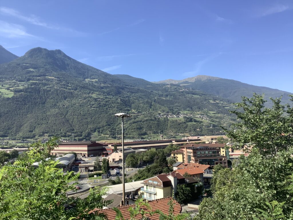
Aosta steelworks – a major employer
From the hillside we got a good view down over Aosta’s extensive steelworks which our hostess told us had attracted migrant workers from other areas of Italy, contributing to the loss of spoken French in favour of Italian in this area of Piedmont. Not that we had noticed that, as most people spoke French to us if they had no English. Our understanding of Italian is minimal at present.
At the village of Saint-Christophe the church was closed and a couple were waiting outside, soon joined by others who were carrying musical instruments. A photographer then got set up, but as our rest period was over we moved on without finding out what they were doing or hearing their music making. We found out later that this 12th century church has recently discovered very old painted frescos, so it was a pity it was closed.
View back across vineyards towards Aosta
From Saint-Christophe we had a steep uphill climb to bring us onto a contouring path alongside a water irrigation channel like those we’d followed previously higher up the valley. This time, though, we were going against the flow, and it wasn’t just our imagination that we were gently ascending.
This irrigation system, known as the Ru Souverou et Prevot, also dates from the Middle Ages and, like the system up the valley, much of it has been put into pipes or concrete channels in place of the original stone and earthen channels.
At Quart we got a glimpse of the Monastere Mater Misercordiae hidden behind a high fence and big bushes. We were greeted by a man working in gardens nearby who enquired about where we’d come from and where we were going, before wishing us well with our pilgrimage. We weren’t sure whether he was one of the monks but appreciated his good wishes anyway.
Chateau du Quart
A little further on we had to descend on a temporary path due to lots of notices declaring the path ‘privato’ and threatening consequences for trespassing, but that brought us past the Chateau du Quart, a handsome collection of stone buildings much in need of serious renovations. The chateau was originally built in the 12th century for strategic reasons, and latterly used as a farm. It has fallen into a bad state of disrepair, leaving its new owner with a big project but the prospect of a fine home with wonderful views along the Val d’Aosta.
We had to walk along a minor road for a while and through a couple of villages. Judging by the paintwork on the road, this route has been used for cycling races, and the messages were giving encouragement to competitors tackling the steep hills around here. We sympathised, though no messages for us on the uphill climbs! Once through the villages we climbed back up and onto another section of medieval water irrigation channels, this one known as Ru Mazod, the name of one of the villages nearby.
Here the irrigation channel was open…And here it is buried in pipes
Much of this section of the walk was in shade, which we really appreciated as the heat of the day had become very oppressive despite a warm wind coming up the valley since lunchtime. There was just one short section which was also lush and green with meadow flowers, but mostly today the countryside smelled hot and made us think we were in South Africa or Australia, the vegetation was so dry, yellow, and sun-burnt.
Looking down onto Nus
By mid afternoon we had only got as far as Nus, which is a little more than halfway from Aosta to Chatillon, and Tom had been struggling with pain in his left calf since mid morning. As there is a train station at Nus we decided to take the train onto Chatillon today, and then see how we feel about returning in the morning to complete the other half of the walk that we’ve missed out today.
First we had to negotiate a long and very steep descent, slithering and sliding down a narrow dirt path twisting and turning down the hillside, trying not to trip on stray tree roots or skid on loose pebbles.
By the time we’d walked down the streets into the centre of Nus near the river at the bottom of the valley we were about to miss the hourly train but, walking past a shop selling coffees and things used for drinking coffee, we noticed a pilgrim sign outside and were able to get our pilgrim passports stamped. The kind lady in the shop also directed us to a cafe/bar where we could get a long cold drink while waiting for the next train.
The train from Nus to Chatillon took about 10 minutes. The 12 kilometre walk would have taken us over three hours, even if Tom’s calf muscle had been up to it, so we made the right call. But we did have to climb steeply uphill about a kilometre from Chatillon railway station to the centre to find our hotel. It has no restaurant, and the bar is closed – despite online advertising to the contrary – but we found a good restaurant nearby which is very popular with the locals and it amply satisfied our need not to walk far to find supper.
Hotel Dufour – lovely setting but bar closed and it’s seen better days
Today’s walk was a trial because of the extreme heat, lack of shade, lack of wind until early afternoon, and the physical impact of the pain in Tom’s calf muscle which also inevitably slowed us down. The views were quite good, but there is a lot of haze due to the excessively hot weather and the views didn’t begin to compare with the magnificent mountain scenery in the days before and after the Col. No one said this would be easy, or that it would all be enjoyable. Tomorrow is another day and we’ll see how we feel in the morning after a good night’s sleep and an ibuprofen or two.
We felt very much in need of our day’s rest today. Are we getting too old for this caper?! In part it is the searing heat which makes the physical effort of walking feel that much harder. Anyway, we didn’t have to walk anywhere today, though we chose to do some sightseeing after a late breakfast and getting our laundry done in the morning.
Our room is in the far corner of the courtyard
The cathedral in Aosta was a surprise, quite unlike any we’ve seen so far. It is much smaller. It is much plainer, with the exception of the elaborate west door, than many of the Catholic churches we’ve visited, and in the heat of the late afternoon it was beautifully cool. A perfect place to stop, rest and reflect.
Inside the Aosta Cathedral The elaborate west door of the Aosta Cathedral dates from 1846
It originates from the 11th century, was consecrated in 1025 and modified in the 15th and 16th centuries, with the 19th century addition of the west facade and ornate doorway. The oldest surviving parts of the building are the two towers and the crypt.
Outside on the south side of the cathedral is an altar-sepulchre commemorating the 9th centenary of the death of Saint Anselm in 1109 in Canterbury.
Altar-sepulchre dedicated to St Anselm – made by a Bristolian sculptor and replicated at Canterbury Cathedral
In St Anselm lies an important link with Canterbury, and of course the Via Francigena pilgrimage. St Anselm was born just south of Aosta to an established noble family. Arguably, his parents’ marriage was for the convenience of agglomerating property. After some time pondering and arguing with his father, at the age of 23 Anselm left home, crossed the Alps and wandered through Burgundy and France for three years. Aosta was of course then part of the Kingdom of Burgundy. He reached Normandy in 1059 and the following year, his father having died, he took the decision to renounce his family property and became a novice at Bec Abbey. Over the next decade the Rule of Benedict reshaped his thought. In 1078 he was elected as Abbot of Bec, where he became known for his loving and kindly approach to monastic discipline, especially with younger monks. Following the Norman Conquest of England in 1066 the Abbey was granted lands in England and Anselm’s sponsor Lanfranc was appointed Archbishop of Canterbury. However, when he died in 1089, the Abbey’s property was expropriated by the new King William Rufus. Despite Anselm being favoured to succeed as Archbishop there followed a turbulent relationship between him and the king, principally over the king’s wish to hold control of the Church in England over the Pope. How interesting it is that this same issue should persist for several hundred years, through Becket and on to the Dissolution of the Monasteries under Henry VIII! Might one argue that Brexit was simply a 21st century manifestation of the same in the context of our more secular environment?
In the event Anselm was eventually appointed Archbishop of Canterbury, despite the fact that William Rufus refused him permission to travel to Rome to collect his Pallium from the Pope.
Anselm’s disagreements with the monarchy lasted through the death of William Rufus to Henry I over the same fundamental issues. Henry finally renounced the right of English kings to invest bishops of the church in 1107.
Anselm died in 1109 and was buried in what is now the St Thomas chapel of Canterbury Cathedral but his remains were lost in the fire of 1170. A memorial statue to St Anselm survives above the south west door to Canterbury Cathedral. This can be seen in the photograph of us at the door on Day 16 of our pilgrimage.
St Anselm is the second statue from the right above Tom’s head
In addition to its relevant Christian past, Aosta was an important Roman settlement and, despite centuries of plundering stone for other buildings, there are still several impressive remnants of Roman buildings to be seen, including part of the colosseum, the city walls and guard towers, and the four entrance gates.
Aosta’s Roman colosseum Aosta city walls and guard towersPraetorian gate – eastern gate – into Roman Aosta
On the recommendation of our Australian friend Jude, we also sought out one of the other churches in Aosta for its frescoes, and were able to join a very informative guided tour. We were delighted to find another link with St Anselm because Saint Orso collegiate church was built at the behest of Bishop Anselm in the 11th century. Most of what you can see inside the church now dates from its 15th century rebuilding, except for a Roman mosaic recently found underneath the floor of the choir.
Roman mosaique uncovered beneath the modern floor
The older parts of the church which were retained during the later 15th century rebuilding are the crypt, the frescoes in the roof space, and the adjacent cloister.
The simple romanesque cryptOne of the frescoes in the roof space, partly obscured by the newer vaulted ceiling over the naveBiblical story-telling on the carved pillars of the romanesque cloister
Having done more sight-seeing than we had intended, our day of rest would not have been complete without an Italian ice cream, which was delicious and pleasurably cold for a sweltering afternoon. We also eventually tracked down an adapter to allow us to use a standard European plug in non-standard Italian electrical sockets. We found it in “the Chinese shop” recommended by the several phone shops we tried and by the tourist office. It stocks everything!
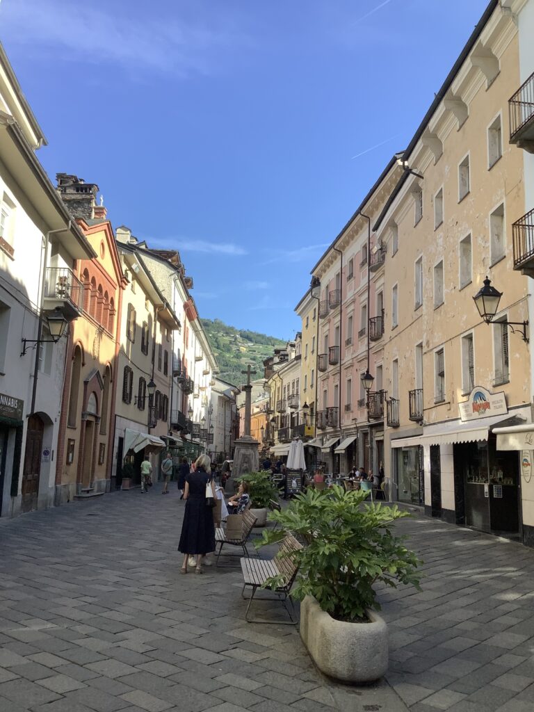
Aosta street life – and note the ornate metal balconies
Aosta has turned out to be more interesting and important to our pilgrimage than we had anticipated, particularly with its strong historical link to Canterbury, the starting point of the Via Francigena.
Another very comfortable night at the Hotel Bon Sejour. A large room with balcony facing the evening sun helped dry our daily laundry quickly. At 1280m it was considerably warmer than at the Col. We spent a convivial evening with our Hungarian friend Rosita and our two friends from Zurich Beat and Martin. Rosita started the VF at the Col du Grand Saint Bernard. She is a regular visitor to Italy, and speaks good Italian. Beat and Martin started in Martigny and were finishing in Aosta. They are both retired engineers from Zurich and regularly enjoy the mountains together. Too much chatting meant we didn’t get our blog done!
View from our balcony – round to our left was a busy campsite
A late-ish start followed by a visit to the bakery adjacent to our hotel meant that the heat of the day was already building. Some confusion over our route also delayed us, but we were grateful to be off the main road when we eventually found the path. Traffic from the tunnel has by this stage joined that from the Col and the road is both busy and fast.
Hotel Beau Sejour at Etroubles Our VF app directed us down the busy road which we didn’t like, feeling quite exposed to the fast traffic. Once we found it, the signposted route higher up the hillside was far preferable.
After regaining some height, which seemed counterintuitive, our path levelled out alongside the Ru Neuf irrigation channel which we were to follow for a good part of the day. The Ru Neuf was originally built in the 15th century after the people of Gignod obtained permission from the Bailiff of Aosta to build it to supply water for irrigation of their hillside meadows. It is something like 13 km long flowing at an altitude of around 1200m, in many places on quite steep ground. Today much of it is concrete lined, but extensive sections are still rock and soil. Alongside it is an excellent path, which makes for very pleasant walking. At times there was the illusion that the water was flowing uphill. We’d experienced this sensation before when walking the levadas in Madeira. Somehow the effort to move forward on an almost level path gives the sensation of being uphill!
The Ru Neuf – here a concrete lined section…….…….and here the original (?) soil/ rock construction.
Every now and then we were blessed with quite magnificent views, up, down and across the valley. At one point, looking up the Roisan valley we could see the snow covered mountains just to the west of Cervinia and the Matterhorn. This reminded Tom of a wonderful skiing holiday there in 1986 organised by his sister, where he was introduced to skiing.
View up the Roisan valley towards the Cervinia ski grounds.
Along the path at intervals we found benches to rest on, constructions to do additional exercises we didn’t feel we needed, and installations related to the Via Francigena. We particularly liked the statue of a pilgrim who reminded us of Julie’s uncle with his flowing beard, and a small grotto that had been turned into a shrine by local people to give pilgrims encouragement on their journeys.
Tom with Julie’s Uncle NormanWe liked the umbrella over the Madonna!
All good things come to an end, and above Gignod we had to leave the comfort of contouring with the Ru Neuf water channel and slither down a very steep slope bringing us to the edge of the village.
Tom checking the route before we slither down the path to the laft
There had been ominous black clouds gathering behind us all morning but apart from a few large drops of rain we just had a brief period of respite from the full glare of the sun and sat on a wall in the village to eat our bread and cheese. We found out later that there were a couple of benches a hundred yards down the hill next to the church where we’d have avoided the ants which crawled over us and our rucksacks whilst we ate.
The Church of St Ilario at Gignod
Inside the church of Saint Ilario was a cool respite from the building heat and humidity outside. It was built in the fifteenth century and remains largely unaltered. Its condition, including a lovely wooden floor, suggests that it is well used and has an active congregation. Indeed a leaflet entitled Religious Tourism in the Aosta (also in French and Italian), suggests that the Diocese of Aosta is alive and welcoming, in stark contrast with much of what we have seen and experienced on our journey through France. Quoting from that leaflet:
“ If you are staying with us for some time, please do not hesitate to regard this as your church; you are warmly invited to the Sunday services, to our community prayers or even just for a moment of silence or prayer.”
It has been noticeable that most churches we have passed since we entered Italy have been open and well cared for. Is this a consequence of the divided responsibility between Church and State in France? Or are the Italians simply more engaged with their Church?
The church of St Ilario with its Murano (Venetian) glass chandelier
While we sat for a while on a bench (without ants) close to the church, we noticed people beginning to gather. It soon became apparent that something was about to happen. Despite the absence of formal clothing we concluded that it was probably a funeral, so we quietly departed.
By this time Rosita the Hungarian pilgrim had caught up with us and we walked together for a while chatting until she found a place to drink a coffee which she had so been looking forward to. We decided to press on, but were stopped by a British cyclist who rushed after us, explaining that whilst it had taken us two days to get down from the Col he had just done it in a couple of hours, travelling at 50 kilometres an hour. It must have been very exhilarating as he was still buzzing. However, he had also walked the VF a few years ago and, recalling how tough it had been, was very encouraging of our efforts and wished us well.
A child’s note of encouragement to passing pilgrims attached to a road sign below GignodView back up the valley from below Gignod
Once we had passed through the small communes linked to Gignod most of the remainder of the day’s walk was urban, some of it alongside the main road into Aosta. Just before we arrived into Aosta proper, the path diverted us up through a vineyard and orchards. Although reluctant to have to slog uphill this late in the day we decided to do it to avoid having to walk in the road around some tight bends where we would be very exposed to speeding drivers.
View over vineyards looking on down the Val d’Aosta
We were rewarded with good views on down the Val d’Aosta, before having a long stretch downhill into Aosta, giving the knees, calves and toes another hammering.
The last half an hour straight down the hill into Aosta at the bottom. The photo doesn’t really show how steep it was.More pilgrim lamp posts in Aosta
At the bottom of the hill we were soon into the town centre, passing the regional hospital and then walking through busy pedestrianised streets to find our lodgings tucked away down an alley in a courtyard behind high metal gates.
Regional hospital in Aosta – much like any other European hospital with people sitting outside the grounds smoking
Our hostess later told us that Covid hit them very hard here as they were not allowed out for almost three months except to buy food, collect medicines, and in her case to take food to her parents who are in their nineties and live nearby. Fortunately her parents have survived their ordeal, but the mortality rate in this area was very high.
Just before turning into the alley where our lodgings were we were hailed by our Icelandic friends Oli and Inga, who were enjoying an afternoon coffee at a street cafe. Oli was reconsidering his plans to continue across the Po valley in view of the extreme heat. We told him we thought that would be wise and better to stop and return in September.
So, highlights of the day? Well, that has to be the lovely ‘levada’ walking and of course the stunning views. But all of that came at the cost of some steep descents and painful toes, calves and knees.
The Auberge wing of the Hospice was very comfortable and the demi-pension supper more than adequate. Although our room overlooked the main road over the pass, the traffic quietened right down overnight, so we got a good night’s sleep and gave ourselves an extra hour’s lie-in as well. It was surprisingly cold overnight, necessitating full duvets which we’ve not needed for several weeks in the current heatwave.
View west from our bedroom window – looking into Italy. That’s the border post on the road on the right.
We got off to a slow start today, leaving the Auberge just before 10am to walk around the west side of the lake and into Italy. The border post was not manned, and apart from a notice to incoming drivers to ensure they have paid their Swiss road tax there was no formality in either direction.
Most of the day was spent making a very steep descent down the valley towards Aosta, giving knees, calves and toes a bit of a hammering, but the views were stupendous. The Alps this side of the Col are even more dramatic, with lots of jagged peaks.
A last look back at the Col du Grand St Bernard Hospice
From the end of the lake our route dropped steeply downwards, crossing and recrossing the road. The peaks on both sides were impressive, and we watched a helicopter at work delivering what looked like supplies to a mountain hut to the west. Part way down we met one of the two Swiss people from Zurich we’d made friends with yesterday. He’d been up to a peak above the valley where there is a good view of Mont Blanc. The photos on his phone looked impressive.
Finding our way off the col
Several sections of our path were paved with large rocks, some of which had been grooved over the years, such as we’d seen on the other side of the Col yesterday.
Paved path below the viaduct road up to the ColLooking down the valley to La Cantine, formerly also a hospice
As we had found on the way up to the col, again today there was a profusion of beautiful wildflowers and butterflies. We also saw another marmot just above La Cantine but, like his Swiss cousins, this one also was too quick for the photographer.
The bikers were clearly enjoying all those switchbacks coming down off the col
At one point we passed a mule coming up, laden with the luggage of a large party of Italians on their way up to the Col. We chatted to a pair of them who asked about our venture.
After a fair amount of descent we arrived at the tree line again with occasional conifers soon becoming stands of trees, as we contoured initially and then descended more steeply. The tunnel under the Col then emerged from the mountain side, doing a sharp left turn before continuing on downhill under a protective covered balcony.
The tunnel emerging mid left – it’s almost 6kms long
At one point, while resting, our attention was drawn to an ant carrying a piece of leaf much larger than itself uphill, until the leaf got wedged between a couple of stones. Two other ants suddenly appeared, we thought to help, but in fact there was a bit of a struggle as if they were fighting over who should have the leaf, and then the other two ants went away again. Fascinating behaviour – almost human!
By lunchtime we had reached the village of St Rhemy. It has a delightful narrow cobbled street down its centre, with tiny alleys leading off each side to closely packed houses. One of those houses was a tiny hotel (L’Hotel Suisse), with a menu board outside, so in we went for the most delicious pasta with goats cheese, tomatoes and pesto – no contest with the stale bread and ripe cheese alternative we were carrying for lunch. That went in the bin at our destination!
St Rhemy looking up the valley
A little further down the hill and we came to the village of St Rhemy-en-Bosses with its delightful pilgrim lamp posts and another church which was open. So far Italian churches seem to be open, with visitor books, and pride at being on the Via Francigena. We have a sense that Italian rural churches may be better supported than those in rural France.
Pilgrim lamp posts along the Via Francigena at St Rhemy-en-BosseStained glass of a Via Francigena pilgrim beside the church at St Rhemy -en – Bosses
There was another very steep downhill path from St Rhemy-en-Bosses to the hamlet of Cerisey at the bottom of the valley where we followed the small river as it turned eastwards through fields. This southern side of the mountains seems very much drier than the northern side, with permanent irrigation equipment in most fields, many of them in active use. Indeed, some we have had to dodge to avoid a soaking. We assume that farmers are hoping for a second hay crop as the first has already been taken off.
Descending to Cerisey – this is the less steep section
Soon after Cerisey we found a large tree to sit under for a rest, and were caught up by another pair of pilgrims who completely ignored our “buon giorno”. Perhaps our Italian accent isn’t up to scratch yet. Suddenly, this side of the Col, there are many more walkers, and we’re hearing a lot more Italian in place of the French and some German spoken in Switzerland. Here, Italian is being spoken for preference, although locals seem to be bilingual in French as, of course, Piedmont was historically part of France until relatively recently and the modern border isn’t far away.
Walking alongside one of the irrigation leats
As we followed the river valley we joined a path alongside a water irrigation channel which took us all the way to the next village. We later learned that this is the Ru Neuf which was created in 1400 to provide water to the villages and farms in the valley. It runs along the hillside at 1200-1250 metres above sea level for about 14 kilometres, and is a very impressive engineering feat. As it gently contours along the hillside the path alongside the water channel makes for very good walking, mostly in shade with a waft of coolness off the mountain water gushing along the channel. It reminded us of the levadas in Madeira.
The last stretch of the walk into Etroubles was along the road, so not very pleasant with traffic whizzing by, but once at Etroubles we were able to walk down pedestrianised cobbled streets bypassed by the main road. One of the first shops, a pharmacy, had a pilgrim sign outside indicating that they have a stamp, so in we went to get our passports stamped. We think the pharmacist was being encouraging about our walk but the truth is we hardly understood a word she said! We’re going to have to learn some basic Italian before the next stage of our walk.
Getting our pilgrim passports out for stamping at the pharmacy
From the pharmacy it was a short walk to our hotel across the other side of the river via a pretty wooden covered pedestrian bridge. By this time we had caught up with another pilgrim who was walking alone, Rosita, a teacher, from Hungary, who we invited to join us for supper as we were all staying at the same hotel. Our two Swiss friends were also there so it was a jolly evening of interesting conversations.
Today was a big day, much anticipated since we were in Kent in early March and saw the sculpture representing the whole of the Via Francigena. It made crossing the Alps look extremely daunting – almost insurmountable. We needed to climb 1100 metres in total today, allowing for losing and regaining height during the day. That’s about 3,600 feet.
Our auberge last night was simple and comfortable, and our hostess was very friendly and helpful, pressing bottled drinks on us to help us on our way this morning. We had to decline the extra weight as we’re already carrying two litres of water each.
Auberge les Charmettes in Bourg St Pierre
We decided to make an early start this morning to try to complete most of the walk before the hottest part of the day, and set out before the sun had risen over the top of the mountains. Although we only had 11km to walk, we needed to gain over 1100m overall to reach the Col.
Leaving Bourg-Saint-Pierre before sun-up
The day started inauspiciously with an ascent followed by a descent and river crossing, but we then had a steady climb up to the dam of the Lac des Toules. It was good to get most of the climb done in the early part of the day. The views up and down the valley were magnificent, and today the wild flowers were beautiful and profuse.
Walking down to the river from Bourg-Saint-MartinLooking back down the valleyClimbing up to the dam
On the way up to the dam we surprised a group of marmots out enjoying the early morning sun. They scampered off to a safe distance and looked back at us before disappearing into their burrows. They were much too quick for us to get a photo, but we saw some stuffed marmots in the museum at the col later – so you can see what the photographer missed.
The path then followed around the west side of the lake above the dam, undulating in and out of ravines and crossing streams pouring off the mountains. As with all the mountain lakes we’ve seen, the water was turbid with sediment coming down off the mountains. Along the lakeside we were overtaken by two Swiss gentlemen who had also walked up from Martigny and are heading onto Aosta, and we later overtook them resting. They passed us again later, so we had several good chats with them during the day.
At the top end of the lake what had looked like possible fish farming from a distance turned out to be banks of photovoltaic cells floating on pontoons. Far better practice than covering productive arable land with them, as we’re doing in the UK.
The wild flowers were abundant and beautiful throughout the day, in lower pastures and on the higher ground above the tree line. The butterflies liked the flowers too, and we saw several that were different from those we’d seen previously. Unfortunately, like the marmots, they were too quick for the photographer.
Above the lake we kept hoping and expecting to get a glimpse of the col around each corner. Tantalisingly, however, it was only within the very last thirty minutes that we could actually see it. We did get a good look back at the glacier we’d seen from lower down the valley though, sparkling in the sun on top of Mont Velan, towering far above us to the east.
Tom making his acquaintance with the locals – the col somewhere far left beyond where the road is headingWe had to lose height to cross the valley and then contour above the road – the tunnel is somewhere under the mountains ahead
We were intrigued by several well made sections of the path and wondered whether their origins might be Roman or Napoleonic. Both brought armies through here and made themselves very unpopular with the locals by devastating the countryside to feed their armies and leaving the local population starving for several years afterwards. On the other hand both the Romans and Napoleon improved the infrastructure so as to maintain the security of the pass, a key strategic and trading route.
A once well made track above the road – Napoleonic perhaps?The col must be around this corner, surely? First sighting of the Hospice on the col – at last!
The final section up to the col was the steepest of the day, but with the col in sight we just kept plugging away.
Julie plugging! Tom going over the topAt the top at last!
It isn’t until you’re right on the col that you can see the huge buildings of the Hospice. Hard to imagine that in winter the snow is stacked deep against these large buildings. The title of Hospice refers in this case to a place of refuge for pilgrims and other travellers, rather than our present English usage as a home for the terminally ill. The Hospice de St Bernard was first established by St Bernard (of Aosta) in the eleventh century, Since then it has been run by Canons Regular. Today the eastern building contains the accommodation for the canons, the chapel and dormitories for visitors. The western building contains an hotellerie, where we stayed.
The two Hospice buildings straddling the road
Just beyond the col is the lake and Italy, where we’ll be heading tomorrow.
Of course a visit to the Col du Grand Saint Bernard wouldn’t be complete without checking out the St Bernards, and so we did the tourist thing as we had arrived in good time. We were disappointed to find that the dogs were completely unresponsive to humans, but perhaps they’re too used to being gawped at all day and bored by visitors. We hope they also get some exercise and stimulation at other times.
There is also an interesting museum about the history of the Hospice and the role the dogs have played in mountain rescues, particularly in winter when they’re reputed to be very good at finding people buried in snow. There is an ongoing breeding programme to continue the line of the first dog, Barry, who came to live with the monks in 1800.
The chapel
Inside the hospice there is a surprisingly large chapel with a striking painted ceiling and richly carved choir stalls. It appears to have been well supported historically as the treasury has some very beautiful and priceless items in it, including old illuminated manuscripts and other beautifully crafted objects which were given to the monks over the centuries.
Breviary de Mont-Joux dating from 1475
We had hoped to attend a service in the chapel but, having arrived for the appointed time, nothing happened so we gave up and went to supper.
In many ways this was the best day of our pilgrimage so far. Spectacular views up and down the valley, all in sunshine with a pleasant breeze blowing up the valley. Beautiful wild flowers everywhere, and lots of pretty butterflies enjoying them. The horizontal distance we covered was relatively short at about 12 kilometres – most days we’ve been walking 18-25 kilometres – and the vertical height gained proved not to be as arduous as we had anticipated. All in all, an excellent day – one of the best so far!
Jenny wasn’t wrong: we had a good meal in the hotel restaurant last night, and Tom liked the beer. He was actually a bit taken aback to be given an extra beer for free, but didn’t feel he could turn it down.
The rather grand looking Hotel Terminus – the rooms are in a modern block behind
This morning we found a small supermarket around the corner to buy provisions for lunches for the next few days as there will be no supermarkets in the remoter places near the Grand St Bernard pass. By then the tourist office was open too so we were able to get our pilgrim passports stamped.
We first crossed the river Drance d’Entremont and then began climbing up out of Orsieres, initially following tracks through meadows and then mixed deciduous woodland, with wonderful views back over Orsieres and the valley we ascended yesterday. We passed several wooden chalets with stunning views and pretty gardens which looked like they are probably holiday homes. Not a bad place to spend your holidays!
Looking back to Orsieres. Note the massive schistosity plane on the mountain to the left
Most of today was spent gaining altitude, from about 890 metres at Orsieres to 1640 metres at Bourg-Saint-Pierre, so a decent chunk of the total 2480 metres height at the Grand St Bernard pass, but there is still a fair amount of climbing to be done tomorrow.
Mid morning saw us descending back down to the river which we followed upstream briefly, and then had to climb very steeply up and over a spur.
And then back down the other side, but now we had magnificent views ahead and by lunchtime we were walking through the village of Dranse. Having scrambled over extensive road works to install sewers into old houses we spotted a wooden barn sitting on staddle stones which provided both somewhere to sit and shade.
The concrete ledge in the shade provided a handy lunch stop
Just up the road we found a tap to refill our water bottles, though had to compete with a group of young cyclists keen to push in before we’d filled all four of our bottles. Expecting people to wait their turn seems to be a peculiarly British trait. Adjacent to the tap and water trough was an attractive, simple, open sided stone chapel built in 2001. What a beautiful location for it. We noted that metal grilles had been fixed over the effigies – rather than locking out the people who might steal them – hurrah!
Onwards and upwards for the afternoon. The path came out of meadows below a concrete reservoir, and then continued up the river valley.
We were making good progress and anticipating arriving at our destination by about 4pm, but then encountered a massive rockfall which had completely taken out the path. It extended a good 200m above us, where we could see a huge rockface which had collapsed. We could actually see where the track emerged the other side, but it was some distance away. New growth of saplings amongst the blocks of rock suggested it wasn’t recent, but it was difficult to determine how stable it was. Moreover there was no obvious route across the mess of large rocks and fallen trees. It would have been very difficult to get across it with our rucksacks, and we didn’t want to risk breaking any bones or twisting ankles.
We decided that the only option was to retrace our steps some 2km back to a bridge over the river and cross over to the east side of the valley. Given that we’d been about 15 minutes from the edge of Bourg St Pierre, the backtracking, loss of height and the reclimbing seemed tiresome.
The barrier which should have been across the path leading to an impassable rockfall
We were now walking in full sun instead of woodland shade and regaining height, so it was tough going, especially with the thought that we should by now be showered and resting, but the views were glorious in all directions.
View up the valley towards Bourg-Saint-PierreView back down the valley – Tom slogging up the hill
The last half kilometre was on the main road but the traffic was much less than earlier in the day so it wasn’t too bad. We found our auberge in the middle of the village, away from the main road, and received a very friendly welcome.
Highlights of the day – one spectacular view after another, and getting to 1640 metres. Only about 800 metres more to be gained tomorrow, which is probably going to be our toughest day so far.
We awoke to another day of bright sunshine and warm temperatures. The saving grace is that in the mountains we are getting the benefit of a cooling wind as slabs of colder air drop off the tops. The two local boulangeries advertising that they are open on Sunday mornings were both closed, so no filled rolls for today. On a positive note, as our hotel was well outside the town centre we had a shorter walk to get clear of urban streets and onto wooded hills.
A micro hydroelectric scheme just outside Martigny
Just above Martigny the Dranse valley narrows, with river, railway and road squeezing through a narrow gap between steep mountainsides. Our path initially contoured alongside the railway, but then took to the steep hillside above it for a while before descending again and taking us to the other side of the valley. The path was quite steep at times, with a precipitous drop to our right, and we found our walking poles usefully reassuring for balance.
Contouring beside the railwayCrossing back under the railwayBridge over a steep ravine and then further steep descentMore impressive Swiss engineering to get us across the valley
Back on the other side of the valley we first had to cross the main road, which proved to be the biggest challenge of the day. The flow of traffic was constant, and it was fast in both directions. In the end we crossed one half of the road in a gap in the traffic, and the car coming from the other direction stopped to let us complete the crossing. We think we may have been breaking a law but there was no other way!
Picking our way behind a service station we followed a minor road into Bovernier where we had to take the train to bypass the landslide which had taken out our path in a recent storm. The train arrived on time and delivered us to the next station at Sembrancher in about 5 minutes, saving us about an hour of walking.
We could see the landslide from the train, and there is no way we could have got around or over it. The only alternative would have been to walk at the side of the busy main road, but that would have been both unpleasant and unsafe. Walking past the Mairie in Sembrancher we found an official notice stating that the path was closed because it was too dangerous to use, and that made us feel a bit less guilty about having taken the train. Typical bureaucracy though, to put up a notice without considering how those affected might learn about it as we only saw it by chance.
Our other practical problem for the day was solved by having lunch at a cafe in Sembrancher. Tom had his first Swiss hamburger which was tasty but enormous! Lunch over, we faced a steep uphill climb out of Sembrancher but were rewarded with wonderful views, both up and down the valley, giving us a good excuse to stop frequently to admire them.
We spent the afternoon working our way up the side of the valley of the Dranse d’Entremont river towards Orsieres, sometimes in woodland and sometimes walking through fields, gaining several hundred metres in height. There were wonderful uplifting views of mountains and clear skies in all directions. This is real Sound of Music scenery! We were amazed to see both vineyards perched on terraces on the south facing slopes, as well as potatoes and even edelweiss being cultivated high on other slopes.
View back towards Sembrancher tucked away distant left – the greyish field beside the track is rows of cultivated edelweiss
Climbing up to the small village of La Garde we found a tiny chapel which was open and positively welcoming visitors, recognising that it lies on several walking paths including the Via Francigena – hence all the yellow signs outside.
Just around the corner we were hailed by a young woman who spotted the banners on our rucksacks and told us she was brought up in Canterbury. Jenny has lived in Switzerland for many years and is now settled here with a young family and husband who is a mountain guide. She was very interested in our pilgrimage and later sent an encouraging email, which we very much appreciated. These chance encounters lift our spirits and boost our resolve to keep going.
Le Catogne on the west (our right) side of the valley
Approaching Orsieres we began to get better views of the valley we will have to climb tomorrow, with the snow-capped peak and glacier of Corbassiere on the far horizon. We will leave that to our left as we go up the valley behind the second ridge towards the Grand Saint Bernard pass.
The final stage into Orsieres took us uphill for more stunning views, across a stream, and then steeply down into the town.
We found our billet very easily as it is right next to the railway station, though we had to wait for a train to go through before crossing the line.
Steep descent into Orsieres
Jenny told us that the hotel restaurant is very good, so we’re looking forward to a good supper tonight!
Highlights of the day? We enjoyed the brief train ride. The views were spectacular all day and in every direction. It was lovely meeting and chatting with Jenny.